For more than 200 years, a large part of the U.S., East of the Mississippi, was actually French territory.
This chronology focuses on historic events of that time and place, particularly those that took place in the Lake Champlain Valley.

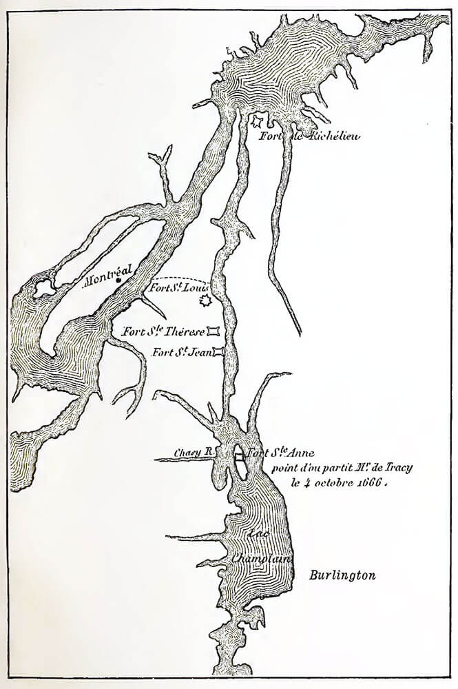
Captain Pierre La Motte and his Carignan-Salières regiment build Fort St-Anne on Isle La Motte (now Vermont). Construction was completed on July 20, 1666.
Map: from the 1890 book “Le fort et la chapelle de Ste. Anne à l’ile La Motte, sur le lac Champlain“.
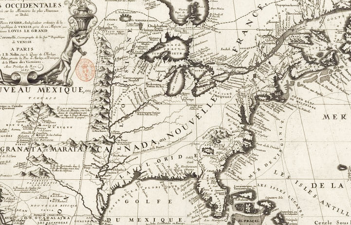
On April 9, 1682, René-Robert Cavelier, Sieur de La Salle claims the Mississippi River basin for France and gives it the name Louisiane.
Article: La Salle’s Shipwreck – An Exceptional Archeological Find
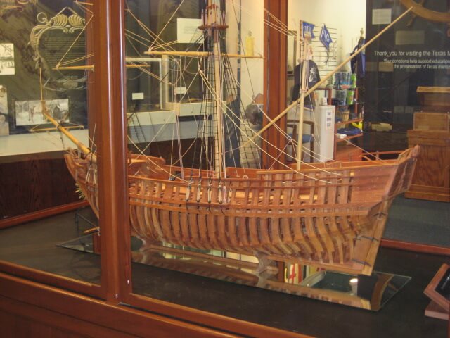
In early February, La Belle, one of the ships of Cavelier, Sieur de La Salle sinks on the (now Texas) coast.
Article: La Salle’s Shipwreck – An Exceptional Archeological Find
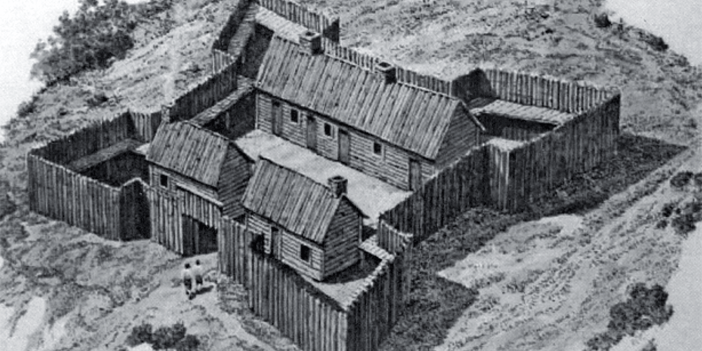
A wooden fort was built in the summer of 1731 on the eastern side (now Vermont) side of the lake. Pointe-à-la-Chevelure. It was completed in October 1731 and operated until the late summer of 1735.
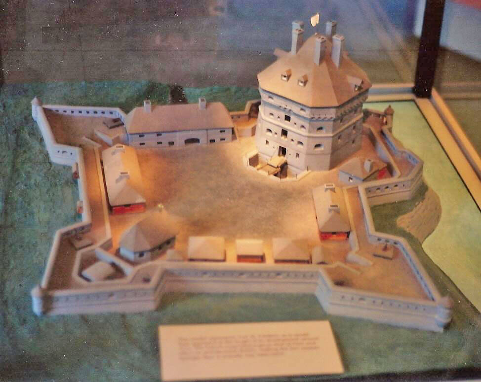
Gaspard-Joseph Chaussegros de Léry, Louis XV’s Chief Engineer of New France started the construction of the fort on the western side of Lake Champlain (now New-York State) in the spring of 1735.

In October 1755, Michel Chartier, seigneur of Lotbinière, supported by the infantry captain of the Queen’s regiment, Joseph de Germain, began construction of the fort, which was initially called Fort Vaudreuil. The construction of this fort with wooden bastions lasted until 1757.
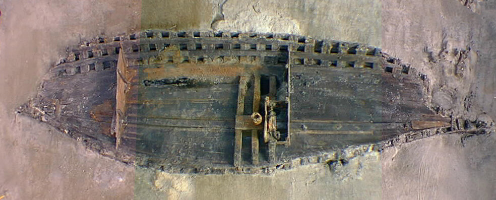
La Belle shipwreck, one of Sieur De La Salle’s ships, is finally discovered, more than 300 years after it sunk.
Article: La Salle’s Shipwreck – An Exceptional Archeological Find