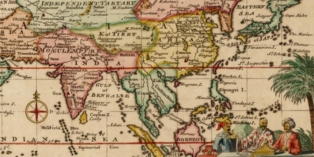
Photo credit: Rare Maps
It seems that a number of people are looking for a map of Marco Polo’s travels (as shown by my blog traffic data). So here is the best one I found.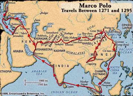
Updated March 14, 2021: I searched for a better map and I found two interesting sources. This web page Marco Polo Route to Asia (Page 1) has a number of maps showing Marco Polo’s Travels. Our friends at Rare Maps, who have allowed me to use their maps if I credit them, sold this beautiful 18th-century map – A Map of Marco Polo’s Voyages & Travels in the 13th Century through a great part of Asia, all Tartary, the East India Islands & Part of Africa. On the map, you must look for the little red dots to see where Marco Polo traveled.
So where did Marco Polo’s travels take him? Well, he left from Venise, Italy in 1271 and traveled throughout what is known today as Turkey, Iran, Afghanistan, Tajikistan, China, Singapore, Indonesia, India for 24 years. Quite a trip, no?…
Interested to know more? The 2001 National Geographic articles “on the traces of Marco Polo” (see my previous posting) offer great insights into his adventures. It is fascinating to see that nowadays some of the traditions observed by Marco Polo at the end of the 13th century still exist. The last article also includes an amazing photograph of a copy of Marco Polo’s travels book, annotated in the margins by no one else than Christopher Columbus. Simply unbelievable!
And if you are interested in other explorers and their discoveries, make sure to check this article on Samuel de Champlain’s explorations of the N.E. of the United States, at the time of New France. I could not find a complete map of his 6 voyages, so I created it.